By Eric Smalley
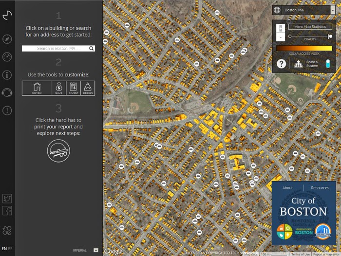
The Boston Solar Map just got a lot more useful. The site has had a high-tech makeover and can give you a detailed estimate for installing a rooftop solar electric system for pretty much any home in the city. Give it a try here: www.mapdwell.com/en/boston. Type in an address – or click on a rooftop on the map – and you’ll be able to see all the numbers, including how many trees worth of carbon you’ll be saving by putting solar on your roof and how long it will take you to break even.
 The estimates include carbon offset (in CO2 tons, trees, 60-Watt lightbulb days, air conditioning hours, driving miles and flying miles), cost to owner, years until payback, and a detailed breakdown of credits and revenue. The Boston Solar Map was made by Mapdwell LLC, which licensed the underlying technology from MIT. In addition to Boston, Mapdwell has solar system maps for Cambridge, Wellfleet, Washington DC and Washington County, Oregon.
The Boston Solar Map assumes an installed system cost of $5.33 per watt. The map uses a sophisticated model to determine the amount of sunlight that hits each roof. Here’s the company’s description:
The tool uses high-resolution (1- by 1-meter grid) Light Detection and Ranging (LiDAR) data to create a three-dimensional model of the sample terrain that accounts for the shape of building rooftops and structures, existing infrastructure, and tree foliage. The model is later used as the base for evaluating the amount of solar irradiation that falls on each unit of surface – for every single hour of a typical year – and determining its individual potential for solar electric generation using photovoltaic (PV) panels.Mapdwell says that its technology has been validated to a 5 percent margin of error.
Take a look at your house on the map, then consider making it happen. Take the next step here: www.nextstepliving.com/partners/rozziesolar.
Tell your neighbors!


